The crew of the Ocean Observer successfully conduct an Environmental Baseline Survey off the coast of Peterhead, in less than favorable conditions. Senior Geophysical Engineer James Lambert talks us through the project.
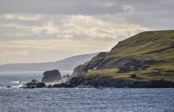
Halloween had just passed and on a cold, rainy day it was time to make the journey up to the Shetlands to join the Ocean Observer which was waiting, barren of Survey Crew, alongside near the ferry terminal in Lerwick. The Shetlands are a subarctic archipelago in the Northern Isles of Scotland, known mostly for their Norse heritage and being a bird migration haven. They sit about 110 miles North of the UK mainland and due to their geographical nature, are quite exposed to North Sea conditions.
The ship itself, from an Underwater Engineering standpoint, was as tidy as ever. The back to back crews onboard have done an excellent job on this ship making things right, which is a testament to their hard work and leadership. As there had not been Survey Crew on for about 10 days prior to joining, everything was left in a semi laid-up state, which meant everything stored away, secured, and the lab completely powered off.
The job this time around was primarily an Environmental Baseline Survey (EBS), for a major Oil and Gas E&P company, with only the need of the Side-Scan Sonar on the geophysical side to help identify areas of interest prior to commencing the EBS.
With the weather in the North Sea forecasted to be horrendous for the next few days, mobilisation was begun alongside and due to the limited equipment being used on the survey, it was completed the same day as each team onboard had all hands available to prepare. Each day alongside, teams spent the mornings chipping away at PMS tasks and confirming their systems were ready to go at a moments notice. Afternoons were spent enjoying some down time before the pending hustle to get things done in the window provided.
There are far worse places to be than Lerwick when you have a little bit of time on your hands to get out and explore. Having just missed the peak of the fall migration, venturing out for some hopeful bird sightings was really not on the agenda. So the crew was relegated to walks through town, along the picturesque seafront, and to nearby historic sites.
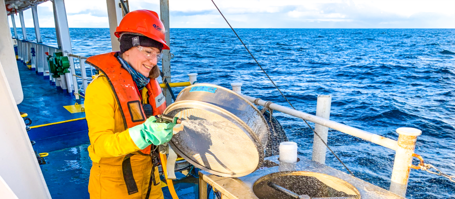
Senior Marine Environmental Scientist Jennifer Ellis prepares a fauna sample using the auto sieve.
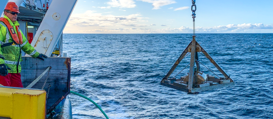
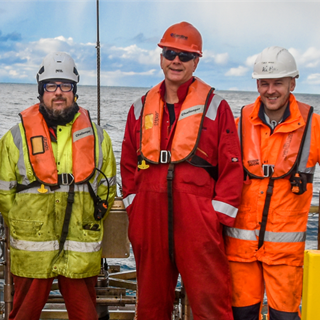
Geophysical Engineer Rick Beard standing by as he observes the day grab being deployed.

Senior Marine Environmental Scientist Alan Rietdyk tapes the shallow water umbilical to the lifting wire during camera deployment
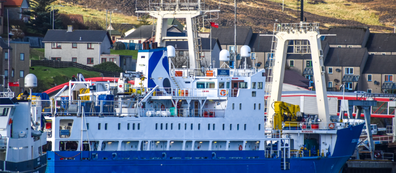
The Ocean Observer, waiting out the bad weather in Lerwick.
After five days waiting out the weather, it was time to seize our moment. Casting off in the afternoon, and with an escort of Orca’s nearby, the Bridge Officers navigated the relatively short journey to the survey area. Shortly after beginning the return line up North, a contact on the sonar peaked everyones interest. A wreck! This wasn't just another day at the office, this wreck was special. It wasn’t on the charts! After the Survey Team and Geo had a look at various sources, it was concluded, that to the best of our knowledge, we may have actually discovered a new wreck. Further along, the rig had moved off the grid and sadly, depending on your perspective, the rest of the geophysical survey went off without further cause for excitement.
After the Environmental Team had an opportunity to review the data and narrow down their camera and grab locations, all departments jumped at the opportunity to assist and make sure those operations went efficiently, and more to the point, safely.
The weather was not too kind during this period and the crew were finding it difficult to maintain a decent sleep pattern. Winds often sustaining a Beaufort scale force 8 and sea states greater than 3m brought the operation to a standstill on a few occasions as camera and vessel control became daunting. However, the crew persevered under the leadership of the Senior Marine Environmental Scientists onboard who had the unenviable task of juggling the workload along with adverse sea conditions, not to mention being cognizant of the client needs.
In the end, and after just shy of 3 weeks onboard, the survey team recovered the last grab sample from the 110m depths. Having satisfied all obligations, the only thing left was to secure the decks and make our way to Hull for demobilization.
Of the job, Senior Project Manager Adam Harding said,
I would like to pass on my thanks to everyone for a well conducted survey. We're really pleased with the performance of the vessel and the team, especially considering there was a particular onus on maximizing the weather windows.
Navigating the Balance
We provide bespoke and forward-thinking environmental services to the offshore energy sector. Let's talk to find out how we can support your project.