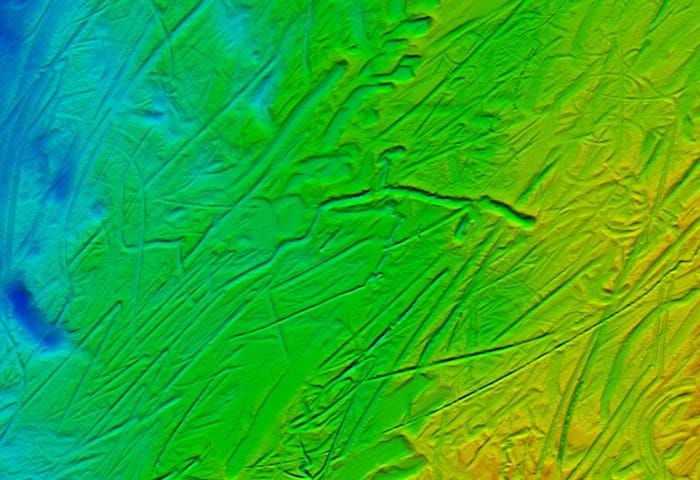
Design and planning are crucial elements in the effective implementation of new submarine cable systems. These rely on the provision of high quality bathymetric geophysical and geotechnical data to determine seabed conditions along the chosen route within the shortest possible time frame in order to meet client requirements.
Expertise, resources and experience
Gardline specialise in seabed mapping services to support the planning and installation of undersea telecommunication and power cables from landfall to landfall.
Gardline operates a fleet of multi-role survey vessels equipped with acoustic instrumentation capable of operating from nearshore to full ocean depth, including swathe bathymetry, side-scan sonar, sub-bottom profiling and magnetometer. In deep water cases where high resolution data is required, deeptow sensor solutions can be provided. Inshore and landfall surveys are conducted either as stand-alone operations or via deployment from the survey mother ship as requirements dictate.
Gardline is well placed to provide competitive turnkey solutions for project requirements.
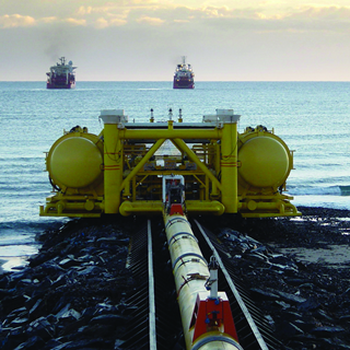
Burial assessment surveys are undertaken using industry standard seabed sampling equipment, however innovative techniques such as continuous electrical resistivity to measure soil properties can be provided. The results are analysed against plough design criteria and presented as burial depth prediction. Desk studies, oceanographic and environmental surveys can also be supplied within Gardline.
With more than 30 years experience in seabed mapping projects and deployment of vessels in all major global subsea markets, Gardline is well placed to provide competitive turnkey solutions for project requirements.
Always above expectation
Let's talk and discuss how we can exceed your project expectations.